

Hurricane Maria — See The Devastation Caused In Puerto Rico

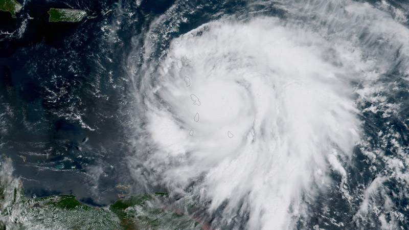
HANDOUT EDITORIAL USE ONLY/NO SALES Mandatory Credit: Photo by NOAA HANDOUT/EPA-EFE/REX/Shutterstock (9066620a) A handout photo made available by the National Oceanic and Atmospheric Administration (NOAA) shows an image captured by NOAA's GOES-16 satellite of Hurricane Maria approaching the Leeward Islands, 18 September 2017. As of 11:00 am EDT, the category three storm was located about 60 miles east of Martinique and moving toward the west-northwest near 10 miles per hour. Forecasters with the National Hurricane Center say Maria, which has maximum sustained winds of near 120 miles per hour, is expected to be a 'dangerous major hurricane' as it moves through the Leeward Islands and the northeastern Caribbean Sea. Hurricane Maria approaches the Caribbean, Atlantic Ocean, --- - 18 Sep 2017